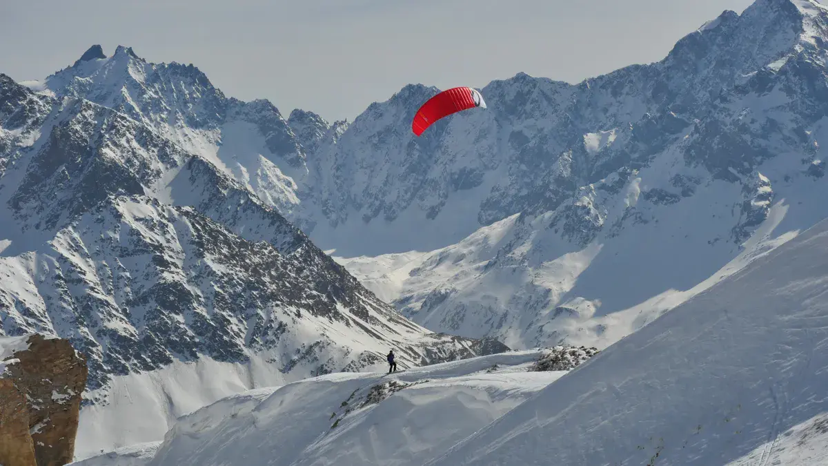
Exceptional snowkite spot at Col Agnel (2,744 m), the 2nd highest paved pass in the Alps, on the Franco-Italian border in the Queyras (Hautes-Alpes). Vast riding area between Col Agnel, Col Vieux (2,806 m) and the slopes of Pain de Sucre (3,208 m), with panoramic views of Mont Viso (3,841 m).
Varied terrain: flat zones around the col, moderate slopes towards Col Vieux, and steeper terrain towards Pain de Sucre for experienced riders. High altitude ensures excellent snow and long season (October to June).
Primarily an end-of-season spot (May-June) when the road is accessible. In winter, the road is closed at Pont de Lariane — access requires a long approach on touring skins (19 km) or Nordic skiing on the groomed trail.
FFVL – French Free Flight Federation
High-mountain snowkite spot in Queyras Regional Nature Park. Riding area between Col Agnel (2,744 m), Col Vieux (2,806 m) and Pain de Sucre slopes.
Late season (May-June): drive to 2,630 m car park.
Mid-winter: road closed, access by touring skins from Pont de Lariane (19 km). Refuge Agnel (2,580 m, staffed) for overnight stays.
Open all year round
Freeride (Ski touring access)
Altitude: 2737m
From Briançon or Guillestre, head towards Molines-en-Queyras then D205 towards Col Agnel. In late season, park at the large car park (2,630 m) 2 bends after Refuge Agnel.
In winter: road closed at Pont de Lariane (1,860 m). Access by touring skins or Nordic skiing (19 km, 720 m gain, ~2h30-3h). Refuge Agnel (2,580 m, staffed) offers overnight stays.
Works mainly in north-west wind. South wind also works, pushing towards Col Vieux area.
High altitude ensures generous wind. The col channels wind between France and Italy.
Watch for Nebbia (Italian fog) rising quickly in south-east wind.
High altitude (2,700-3,200 m): fast-changing weather, freezing wind.
Nebbia: Italian fog that rises quickly, reducing visibility to zero.
Rocky terrain under thin snow, especially around Pain de Sucre.
Steep slopes near Pain de Sucre — experienced riders only.
Avalanches: wind slab risk on north-facing slopes. Beacon/shovel/probe recommended.
Remoteness: very isolated in winter. Bring skins, charged phone, inform someone.
If you notice any outdated information:
Suggest an editLive data from Pian Munè 1890m weather station (wind, gusts, history) is reserved for Premium members.
Already a Premium member? Log in
Loading webcams...
Comments 0
Login to commentNo comments yet.